Tuesday 22 June 2010

Great Sand Dunes National Park

Penultimus Maximus - or in other words, this is the last stop before Denver and then home.


The great sand dunes, America's youngest national park! Now this is getting too coincidental because you'll never guess what - it's on fire!! Luckily this time before we arrived so no blame can be apportioned to us.


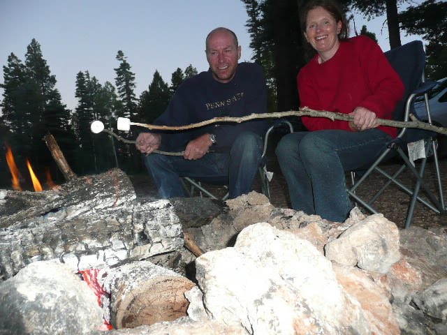
After a little hike up a hill, and wading through a gorge you get to see a hidden waterfall called 'Zapata Falls'. Something tragic happened here! This picture of us at the falls could well have been the last ever with our camera, because after the guy took this picture he dropped our camera, it bounced off a stone and ended up in the water. When I picked it out, it was dead and remained that way despite all attempts to dry it and revive it. So you can imagine how cheesed off we were. So we had tea, had a fire and try to cheer ourselves up - and then, totally out of the blue, the old camera did a Lazarus, it came back to life and I'm happy to say works perfectly again. What a relief, otherwise the blog would have ended right now!

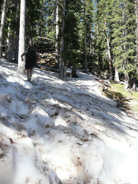
A walk to the top of the sand dunes - not easy climbing sand hills I can tell you!


Just to give you some idea of the size of these things - those are people down there.


The traditional 'long arm' shot from the top of the biggest sand dune, 650ft.


Elvis demonstrating the 'quick' way down. She still has sand in her ears!


The biggest dune - we were at the top of this dune.


Here is the ranger explaining to everyone about the fire. The forest is within the park boundary and is about 5 miles away from us. The authorities have changed their policy on fires these days. Once they would have tried to put the fire out, but in fact the best thing to do is to let it burn. That way, dead trees and pines are burned away and allow new trees to come through. If fires are not allowed to burn regularly, dangerous amounts of fuel build up on the forest floor which usually means everything is burned away, if fires are allowed to occur naturally, usually there isn't enough fuel on the floor to kill the big trees. By the way, this fire was started by a lightening strike on the 5th June.


We've obtained some backcountry passes again, so we're off for a hike into the sand dunes and a night camping on the sand under the stars - or that's what we thought!!


Strangely, the sand dunes are surrounded by water - which is odd for a desert environment. The whole arrangement is quite weired because the sand should really blow away, but a combination of the mountains at the back and the water actually re-circulates the sand and deposits it - a constant recycle kind of thingy!

So here we are - camping on the dunes - anyone think the 'clear, starry sky' looks a little bit on fire? It was an interesting night to say the least, quite windy and very interesting 'firework' display from the nearby forest!


No more cups of tea - cos there isn't another blog to answer the questions!

We have really enjoyed our eight weeks through the national parks of Nevada, California, Arizona and Colorado. Thanks for joining in. Until the next time - chow for now, K&S xxx

Durango and Silverton

Blogs are coming thick and fast now - two in a day!!!
This is the steam train that goes from Durango to Silverton through the beautiful San Juan Forest. For you train buffs (of which of course, I am one) it's a narrow gauge railroad and was originally used for transporting gold and silver ore from the mines. Now at $81 a piece it now transports a much more valuable cargo - tourists... !! Not us though ,cos we have our own wheels!

We chose to drive up to Silverton which is a famous scenic highway and as you can see its just so picturesque. We stopped on the way to Silverton at Coal Pass (1040ft) which is pretty high up to do hike called Trail Pass.


Would you look at this! Snow - the white stuff in the heat of summer! Well, if you've ever seen those snow capped mountains in post cards, that's where we were, at 11,0000 feet above sea level it's cool enough to keep the snow going for a few weeks yet.


Almost at the end of the trail, this is 'Engineer Mountain' which is another 1,000 feet up - but a no go area with snow because it's a little treacherous without snow shoes etc.


It feels like we're in the Austrian mountains again. What a beautiful place.


Photos from the highway. On our way to Silverton.


More scenic highway pics right on the town of Silverton.


Would you believe, there's the train that was in Durango a few hours earlier! I reported in with the driver to inform him that I am a qualified driver myself should he need assistance. I think he contacted security as I was leaving!


For a cup of tea, who used to drive steam trains during world war two?


This is Silverton, an old mining town. It now gets besieged three times a day by mad tourists who arrive on the train with barmy amounts of money to spend on crappy cheesey souvenirs. However, the town is interesting and looks like an old gun-slinger town. It definitely fits the bill as 'a one horse town'.


I'm tempting some mocking here, but you will have to trust me. On this picture is one of the rarest wildlife sightings in North America. What snow on a hill I hear you say - no man, much better than that. While we were sitting having a break, an animal ran accross the top snow pile, which is about a mile away. The picture shows nothing, until you digitally zoom in 16 times and get.....


......this picture. By now I had my binoc's focussed in and could see fairly clearly but didn't actual believe it. A retired park ranger joined us and after a little more research he was convinced that we had just seen the very rare North American Mountain Lion! How chuffed am I. As I was saying to my sister Jen, I wish I could have been close enough to see it more clearly with the naked eye, but as she pointed out, if I was that close, it would probably see you - which is not such a good thing! I wonder if it has yellow eyes when you shine a torch at it????

Express COT - The 'Hopi' tribe are direct decendants of the Puebloans from Mesa Verde and in England if you asked for an 'Indian' you'd be getting a lovely spicey meal, something we'll be having when we get back!!
Answer the COT's quickly because there's only one more blog to go and it will be live very soon!!!

Mesa Verde National Park

Mesa Verde. Does any of you language scholars spot a bit of Spanish going on here? Here's the clue, big flat TABLE mountain covered in GREEN vegetation. Yes, Mesa Verde in Spanish means, horses ass - no only kidding, it means green table and no, it has nothing to do with snooker. The 'green table' is very beautiful, but that's not why we are here. Mesa Verde National Park has a real treasure here that shows how the Indians ancestors lived in America before the Europeans and later, the white Americans took it all off them!


First off though, here is Elvis looking over the 'green table' after a nice little hike to a view point.


Feast your eyes upon this! These two pictures are of Cliff Palace, literally an ancient civilisation dwelling built right into the cliff face (the second picture helps you appreciate the scale).


So what's it all about Alfie? Well around about 1,400 years ago the direct descendants of the native Indians used to live here. Originally named 'Anasazi' from the Indian Navajo word meaning 'ancient foreigners' they are now referred to as the ancestral Puebloans because they weren't really foreigners at all. It's amazing to think that these structures were 'lost' until 1880's when a couple of cowboys came across them. Since then there's been a lot of scientists brains burning the midnight oil trying to make sense of it all. There are no written historic records, so it's not known how the tribes organised themselves, but it is known that the 'pueblo' (Spanish for village/dwelling) marked a transformation in Indian history when they changed from being nomads to farmers and home builders.


The pueblos were built into natural cliff overhangs, which are created over millions of years by water turning to ice and cracking the porous rocks which then fall out of the cliff. The Indians then come along and check it out... "oooh it's got a lovely big kitchen, the patio can go over there, Little Bears nursery can go up there and the TV in the corner"..... that type of thing. The dividing walls were made of hand carved bricks from the sandstone and glued together with mud and straw.


The little hole in the ground (in front of Elvis) is probably not what you think!! It's actually an entrance to an underground chamber called a Kiva, where all the men gathered for meetings to discuss important issues like hunting, farming and who won the baseball game last night.

Despite all the boffs studying the artifacts and the weather at that time, there's still a big mystery that no one really knows the answer too. Around the late 1200's all the villages in Mesa Verde were abandoned! They en-mass travelled south into New Mexico and Arizona and settled amongst their kin who were already there. The Navajo Indians today explain that 'it was time' - in their beliefs it is not normal to live in a place too long or it encourages lazy behaviour and evil spirits. If the Navajo lived in England we would call them Gypsies. For a COT which other present day Indian tribe had ancestors living in Mesa Verde? And for a bonus, if you 'went for an Indian' in England, what would you expect to happen?


This is another view from the green table from a lovely little six mile hike.


At the end of the hike, much further than most people go, we discovered an ancient tribe that must have been missed, we sneaked up and took this picture of a day in the life of an Ancestral Puebloan. We left when the bloke in the middle of the picture (the one with the man-boobs looking out of the window) spotted us and threatened to set the dogs on to us.
Just a little historical fact that occurred to us when we were looking at these dwellings. Isn't it incredible how civilisations developed at such incredibly different rates. Here in 1200 Indians are making caves with stones and mud, about the same time, just up the road from where we live, Durham Cathedral was opening up for business. If you think how long the pyramids have been around then it does get bewildering. Anyway, we will leave you all to ponder that one! I think I'd have liked to have been an Indian.
COT - A gopher snake is the correct answer OS (no teasing this time). An Un Big One is correct with the steps taken - i.e. bloody big'uns!

Monday 21 June 2010

Grandus Maximus - The Grand Canyon!

Well here we are in America's most famous natural attraction and well ...... words and pictures cannot grasp the scale and intensity of one of the wonders of the natural world. Elvis and I stood on the rim, peered down and just soaked up the multi layered rocks, cliffs and crevices, it's just an incredible spectacle of technicolour rock strata (oooooh - alphabet soup for lunch). Such an amazing sight, it brought tears to my eyes (well Elvis' actually) and a lump in the old throat!!
For you fact buffs the canyon is 277 miles long, roughly 10 miles wide and a mile deep. It's been carved by the Colorado River over millions of years with the oldest rocks being 1800 million years old.
This is the Grand Canyon on the south rim, the GC is treat like two parks, North and South because although they're 10 miles apart if you were a crow, if you're in a car it's a massive 275 miles. Most people visit the more 'tourist friendly' south rim. We had plenty of time so we visited both sides.


Sitting perched on the edge just trying to take in the vista. This is the view from just a little way from our camp site at desert view.


There's much talk made of how the light changes at different times in the canyon. This picture and the next picture are of the same place. Look how the colour has completely changed the look. These pictures are only capturing a small portion, imagine this view spread right across your vision from left to right. It takes your breath away.


It's 4.30am and Elvis and I are about to venture down to the floor of the canyon. You need a back country
permit for this and these are few and far between, usually booked six months ahead. Miraculously we managed to get one for both campsites and here we are ready for two nights camping below the rim. That our beds strapped to my back - BOTH of them, they don't look too comfortable. We did toy with the idea of strapping a double mattress to our backs.

No pictures for the first 40 minutes of hiking - it was dark! Then the sun rose and we got glimpses of the view down the side of the canyon.

Supposedly hiking down into the canyon is a most breathtaking experience and they're not wrong there! This is just a short way into the South Kaibab Trail. This picture shows the road ahead - 'switchbacks' down the side of the canyon. It's a 7 mile steep hike with marvellous panoramic views and for those who are not feeling as active (lazy buggers) you can take a mule ride down and stay in cabins at Phantom Lodge.


This is about one third of the way down, it's hard to take in that all of this was carved by a river and at one time was level with the surface. You really do feel the millions of years it has took to carve it out, and you can clearly see the layers of rocks that were laid down millions of years before that when ancient seas covered the area.


Some inhabitants of the lower levels of the canyon. A perfect environment for 'Charlie Drakes'. The canyon is one mile deep which means on average that the floor temperature is 25 F more than the rim. I wanted to see a rattle snake, but we weren't lucky enough! For a COT can anyone name this species (google snakes of the canyon!!). I think we may have covered this before but does anyone know what steps you take if you are confronted by a snake.

Half way down!! A well earned rest at Tonto's trail


It's hard to explain how beautiful this walk is, we're now deep in the canyon, perched on a path on the side - oh you have to share this with mule trains carrying supplies and passengers! All supplies to the lodge on the floor arrive by mule trains - there's no other way!


When the mules come by - get out of their way - and always make sure you're standing against the wall and not the edge! Just a little trivia - no humans have been killed riding mules, but some mules have died. It's nee the wonder when you see the size of some of the hugies on their backs. This mule train was only carrying supplies - lucky mules!!

A welcome sight - the Colorado River. Despite the red hot temperature down there the river is freezing because it comes from the rocky mountains, which are still covered with snow, it's also got a wicked current and we've already been warned that we can't swim but we can plodge on the sandy shoreline. Nevermind that horse sh*t - straight in!!!

Wahay, just about to cross the suspension bridge, not too far from the campground now.


Phew it was hot, hot, HOT!! As you can see a scalding 135 degrees, me heed was alight. This was about 5pm and the heat continued way into the night with nee need for any of ya bedclothes or extra layers.


This was our first camp spot in Bright Angel campground. It's right on the floor of the canyon and next to the Creek. There's little shade though and we just sat fully clothed in the creek trying to cool down. You have to bring all your food and while we were in camp, a naughty little squirrel nearly had it away with our provisions - lucky it only got a bit of melon, otherwise we would have ate the squirrel (some Americans do eat squirrels you know - my nephew for instance - bloody foul!)

Me demonstrating the 'cooling down' technique!
If I could breath underwater the heed would have been under too!


This was a hike we did from our second campground Indian Garden. You can walk right out and look down into the canyon. I have millions of beautiful pictures from this point, but a picture with us two on is the best I'm sure you'll agree! We stayed to watch the sun set, which is a different experience to normal because remember, the canyon is really a hole in the ground, so the light goes from the bottom quite quickly.


After a night on the floor, we hiked half way up and stayed at Indian Garden (no - it's not a restaurant!) then we set off at 4:30am to beat the heat and make for the top. This picture shows the sunrise hitting the top of the rim but it's still in shade for us. Look at the different layers of rock as you look up the canyon. Each layer represents millions of years.


The sun has finally caught up to us and the canyon is lit in a warm sunrise. It looks majestic.

Hat's on and it's hiking in the sun for the last bit to the top!!


After 4.5 miles completely uphill we have made it up the remainder of Bright Angel Trail. Elvis' fyace has never been so red. We had left that morning in the black dark at 4am and this was 7.10am. It was welcome relief and a great sense of achievement. What did we do next? We got into the car and drove to Williams. We went to a bakery and gorged with cake. We had looked up this place before (the hotel is called the Red Garter) and we wanted to stay but it was way too expensive, but that all changed. While we were eating cakes, the owner said he had rooms available and would give us a special rate. So we took it at half price and that night we had a proper room with a real bed and a Victorian 'claw foot' bath. You should have seen the tide mark around the bath. The hotel was very interesting by the way, it was an old Whoooore Hoose that had been restored. We stayed in 'the Madams' room!!


Yes we are still in the Grand Canyon not at home in Blighty! This is now the North Rim and as you can see git big hail stones on the windscreen and it was a little chilly. The North rim is 1,000 feet higher than the South rim at 8,000 feet above sea level, this means lovely days (in the 70's) but cool nights and the occasional hail storm.


This is an elk just hanging around a junction with three of his mates, not bothered about the traffic at all! It's amazing how animals in National Parks learn that humans aren't a danger. Of course the minute it steps over the boundary they'll be a firing squad waiting for it!


A sunset over the south rim from a place called 'Hermits Rest".


No spots at the campsite on the North Rim so we did some 'dispersed' camping again. Hey, it was great, only us around in this beautiful forest just four miles outside the park and FREE firewood - it was like 'bomby neet' every night! Probably one of the most beautiful campsites ever! We did get a visit one night though, and when I shone the torch, a pair of yellow eyes shone back! I knew deer eyes are red so I wasn't sure what was checking us out!


The North side also has a trail named the 'Kaibab Trail'. This is at the first look out. It is possible for the extreme athletes to hike down the South Kaibab trail to the floor, then up the North Kaibab trail to finish on the north rim. Maybe next time!


The canyon at sunset from the North rim. That's the south rim (where we were a few days ago) in the distance. As I say, only ten miles across but quite a drive away.


This is a picture of a 'side canyon' formed when water runs into the main canyon and cuts away the rock.

We read a quote in the visitors centre -"Some places you see with your eyes, others you see with your heart".
Well let me tell you this ones heartfelt!!

Finally, what's a man to do when he has no toasting forks?

Yes, get 'whittling' - another Hodge money saving tip!


COT palaver - Ooh you judges and the outsourcer - I was just teasing you although good to see that you're awake. Anyway, still well done to Millie (I have to keep in with the mother in law you know!!) Millie, when we get back I'll make you a cup of tea for trying. Outsourcer, stop getting your knickers in a knot, it was Wyatt's little booth after all.